Terrain explorer
3D
Orbit a real DEM, click to read elevation at the cursor, fly to the high/low points, and toggle wireframe – all without rebuilding the k3d scene.
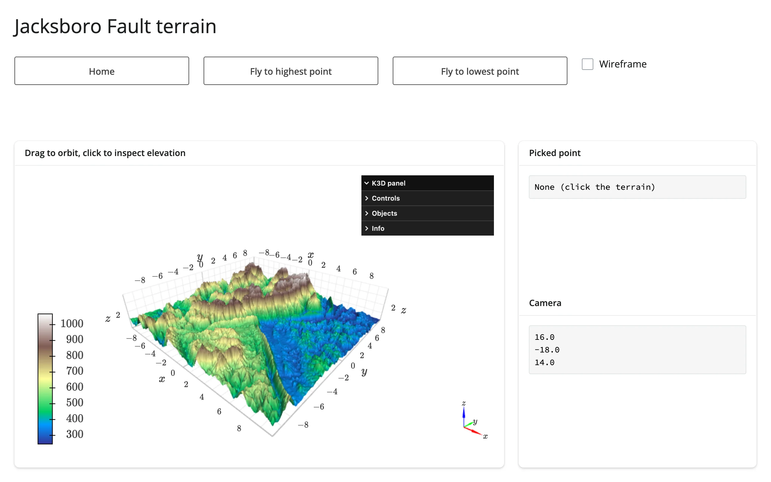
A real digital elevation model (matplotlib’s bundled Jacksboro Fault sample, Texas), rendered as a k3d surface you can drag to orbit. Clicking the terrain reads elevation at the cursor via k3d’s click_callback; two buttons fly the camera to the DEM’s highest and lowest points and drop a marker there; a checkbox toggles wireframe. Every one of these mutates the existing k3d objects in place (terrain.widget.camera = ..., layer.wireframe = ...) – the 139k-vertex surface is never resent.
Run it
git clone --depth 1 https://github.com/posit-dev/py-shinywidgets
cd py-shinywidgets/website/gallery/showcases/terrain-explorer
uv run shiny run app.py
Source: app.py · Open in Shinylive
Try this
- Drag to orbit; scroll to zoom.
- Click anywhere on the terrain: the Picked point card shows the exact elevation and grid cell under the cursor.
- Click Fly to highest/lowest point: the camera animates there and a marker appears.
- Toggle Wireframe.
- Watch Camera: it reads the live camera vector via
terrain.camera(), so it updates after every orbit, zoom, or fly-to – not just clicks.
Accessors demonstrated
k3d’sclick_callback– not a shinywidgets accessor (k3d has noclicked()by design; real picking needsplot.mode="callback"), but the idiomatic pattern this guide recommends: route the callback’s payload into areactive.valueso the rest of the app reacts to it normally.terrain.camera()– the plot’s camera as 9 floats, re-seeded from the new widget on every render and updated on every orbit/zoom/fly-to. Inherent widget state (not kept across re-renders like a click), and neverNoneonce the browser auto-fits.
Verification
No extra packages needed. Two real gestures confirmed against server-rendered text:
- Clicking Fly to highest point moved
terrain.camera()’s first three components to(6.9, 1.4, 9.0)and dropped a visible marker at the peak –img/after_peak.webp. - A real click on the terrain canvas then set the click callback’s payload: Picked point changed from
"None (click the terrain)"to"elevation: 1021 m\nrow, col: 139, 108"–img/after_click.webp.
Source: promoted from docs/widget-guides/k3d/gallery/showcase_terrain_explorer.py (see NOTES.md).